Share


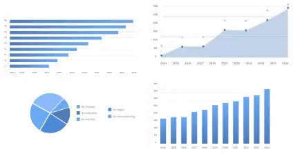
The global Aerial Photogrammetry System market size was valued at approximately USD 4.5 billion in 2025 and is projected to reach USD 9.8 billion by 2035, growing at a CAGR of 7.8% during the forecast period. Aerial photogrammetry involves capturing images from airborne platforms to generate accurate spatial models and maps. This technology plays a crucial role in various industries, including construction, agriculture, forestry, and urban planning, where precise geographic data is pivotal. Major stakeholders include technology developers, service providers, government agencies, and end-users such as architects and engineers who require detailed topographical insights for planning and development.
The industry is currently in a growth phase, transitioning towards maturity, with advancements in UAV technology and imaging sensors driving innovation. The strategic importance of aerial photogrammetry lies in its ability to offer cost-effective and accurate data for spatial analysis, aiding in decision-making processes across multiple verticals. The market is poised for transformation with the integration of advanced technologies like AI and machine learning, enhancing its precision and applicability across diverse sectors.
This segment accounts for approximately 30% of the overall market. The dominance stems from the diversity of product offerings that cater to varied application needs across different industries. High-investment areas like construction and urban planning predominantly drive demand for robust, high-resolution imaging systems. The integration of newer technologies into photogrammetry hardware and software further enhances this segment's relevance, sustaining its market share.
Cameras – 40%: Cameras lead due to their direct impact on image quality and detail, which are critical for accurate photogrammetry.
Drones – 35%: Drones maintain a substantial share as they offer efficient data collection in inaccessible terrains, broadening application possibilities.
Software – 25%: Software facilitates data processing and analysis, crucial for interpreting photograms and generating actionable insights.
With an estimated market share of 25%, this segment represents one of the major contributors to industry revenue. The versatility of applications ranging from agriculture to disaster management exemplifies its broad adoption. Segmentation by application reflects the diverse use cases, with dynamic market demands influencing innovation and technology adoption.
Urban Planning – 40%: Urban planning predominates due to significant demand for precise geographical data to inform sustainable city development.
Forestry – 30%: Forestry applications utilize photogrammetric data for monitoring and managing forest resources efficiently.
Agriculture – 30%: Agricultural sectors leverage these systems for precision farming and crop monitoring, addressing the rising need for food security and resource management.
This segment comprises approximately 20% of the overall market. Rapid advancements in technology are central to this segment's growth, with automation and integration of cutting-edge sensors enhancing data accuracy and processing speeds. Companies actively invest in R&D to stay competitive, contributing to the technological evolution of the sector.
LIDAR – 60%: LIDAR represents the largest share due to its ability to provide high-resolution topographical data, indispensable for effective spatial analysis.
Photogrammetric Software – 40%: This software facilitates processing and interpreting collected data, essential for deriving useful outputs from raw imagery.
This segment accounts for 25% of the total market share, propelled by significant demand across sectors like construction, agriculture, and defense. Each industry segment showcases unique adoption patterns, driven by specific operational requirements and investment capacities.
Construction – 40%: Construction industry holds a substantial share due to frequent use in topographical surveys for infrastructure projects.
Agriculture – 30%: In agriculture, these systems play crucial roles in precision farming and resource management, underlining their significance.
Defense – 30%: Defense sectors leverage this technology for strategic planning and tactical maneuvers, necessitating continuous improvements in imaging and data accuracy.
| Impact Factor | (~) % Impact on CAGR Forecast | Geographic Relevance | Impact Timeline |
|---|---|---|---|
| Technological Advancements in Drones | +1.5% | Global | Medium to Long Term |
| Increasing Demand in Construction | +1.3% | North America, Asia Pacific | Short to Medium Term |
| Integration of AI and Machine Learning | +1.2% | Global | Medium Term |
| Regulatory Support for Urban Development | +1.0% | Europe, North America | Medium Term |
| Rising Adoption in Precision Agriculture | +0.9% | Asia Pacific, Latin America | Long Term |
This analysis indicates significant growth potential driven by technological developments, demand in construction and agriculture, and regulatory support, particularly influencing the market's expansion over medium to long-term timelines.
| Impact Factor | (~) % Impact on CAGR Forecast | Geographic Relevance | Impact Timeline |
|---|---|---|---|
| High Initial Capital Investment | -1.2% | Global | Short to Medium Term |
| Regulatory Restrictions on UAVs | -1.0% | Europe, North America | Medium Term |
| Data Privacy and Security Concerns | -0.8% | Global | Medium to Long Term |
| Lack of Skilled Professionals | -0.6% | Asia Pacific, Middle East & Africa | Long Term |
| Supply Chain Disruptions | -0.5% | Global | Short Term |
Constraints such as high initial investments and regulatory challenges remain, potentially impacting the market's short to medium-term growth despite technological advancements.
The Aerial Photogrammetry System market has shown tremendous growth over the past decade, driven by rapid technological advancements and high demand from diverse industries. Currently, the market is experiencing robust growth due to the increasing adoption of UAVs and enhanced sensor technologies. Applications in agriculture, construction, and defense sectors are developing, leading to higher penetration rates. Investment trends reveal substantial CAPEX in R&D for new technologies and strategic geographical expansion strategies across developing economies.
Growth drivers include technological innovations in drone capabilities that enhance the precision and efficiency of data acquisition methods. The integration of AI and machine learning for data analysis continues to bolster the market's trajectory. Regulatory support, primarily in urban development and smart city projects, propels demand. Noteworthy challenges comprise high costs, regulatory hurdles, and cybersecurity concerns, which industries must strategically navigate to maintain competitive advantage.
The growth is primarily driven by new technology adoption and innovation, geographic expansion into untapped markets, and replacement cycles enhancing the technological base. Industry participants actively engage in continuous product investment, maintaining competitive edge and fostering innovation.
The leading segment in the Aerial Photogrammetry System market is By Product Type, dominating due to substantial investments in advanced camera systems and drones. The segment holds significant market share attributable to its essential role in driving data accuracy and application effectiveness. The fastest-growing segment is By Application, attributed to evolving industrial needs across agriculture and urban planning sectors, which exhibit promising future market opportunities due to the demand for precision data.
Emerging segments such as By Technology illustrate considerable potential for innovation with increased investments in AI-enhanced photogrammetric software, positioning them attractively for stakeholders aiming to capitalize on future technological shifts.
The Aerial Photogrammetry System market continues to benefit from ongoing technological evolution, with modern technologies like LIDAR and enhanced software platforms laying the foundation for efficient data processing and analysis. Innovations in AI and automation integrate seamlessly into data interpretation processes, advancing capabilities and reducing operation times. Major players invest heavily in R&D pipelines to refine existing products and develop new patents, creating competitive market dynamics.
Digital transformation encompassing automation and advanced analytics influences competition by altering pricing structures, increasing adoption rates, and impacting traditional business models. Companies leveraging these opportunities will shape future market landscapes.
The aerial photogrammetry value chain includes upstream suppliers of imaging sensors, midstream manufacturers, and downstream distributors to end-users like architects and city planners. The industry faces cost implications driven by raw material pricing, technology investments, and capacity utilization challenges. Profit margins vary with technological adoption rates, supply chain integration, and market demands, emphasizing efficiency and pricing strategies. Primary interview insights suggest targeted supply chain optimizations as critical for maintaining cost-effectiveness in a competitive landscape.
Regulations significantly impact market dynamics, with compliance and certification influencing entry and operational costs, particularly in UAV usage across various geographies. Industry standards foster competitiveness and ensure quality assurance, impacting innovation and market competition. Regulatory frameworks support urban development initiatives, encouraging eco-friendly and efficient industrial applications.
North America: North America holds the largest market share due to robust demand in construction and urban planning, showcasing mature industry dynamics and attracting consistent investments in new technologies.
Europe: Europe ranks second, closely following regulatory advancements and sustainability adoption trends, aligning with the continent's sustainability directives.
Asia Pacific: Expected as the fastest-growing region due to its manufacturing prowess and favorable investment opportunities in upgrading infrastructure and agricultural applications.
Latin America: Presents emerging opportunities with growing adoption in urban management and resource monitoring, bolstered by regional governmental support.
Middle East & Africa: Develops steadily, with technology deployments aiding in infrastructure and resource management as regional markets mature.
The aerial photogrammetry market is moderately consolidated, with leading entities like DJI, Pix4D, and Trimble commanding substantial shares due to extensive portfolios and significant geographic presence. Market positioning matrices reveal substantial revenue contribution from these players, driving technological innovation through partnerships, mergers, acquisitions, and strategic expansions. The report evaluates competitive benchmarking, company positioning matrix, and market share analysis.
Porter Five Forces analysis reveals moderate entry barriers and a high bargaining power of suppliers due to technological differentiation. PESTLE analysis highlights regulatory shifts, emphasizing environmental sustainability and economic investments in technology. Overall market attractiveness influenced by technological evolution posits pinch points in cost and competitive dynamics.
Strategic foresight reckons significant market attractiveness appealing for sustained investments over the next 5–10 years. Industry participants must prioritize segments where technology integration is critical, such as By Technology and By End-use Industry. Focusing expansion on Asia Pacific will harness the highest growth potential, leveraging regional technological advancements. Companies should navigate risks like regulatory restrictions and cost barriers while embracing capabilities in AI, data analytics, and UAV advancements to sustain leadership positions.
To get full access to our Market Insights, you need a Professional Account or a Business Suite.


You will receive an email from our Business Development Manager. Please be sure to check your SPAM/JUNK folder too.
You will receive an email from our Business Development Manager. Please be sure to check your SPAM/JUNK folder too.
Our customers work more efficiently and benefit from