Share


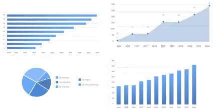
The global Aerial Photogrammetry Surveying Service Market market size was valued at approximately USD 1.5 billion in 2025 and is projected to reach USD 3.2 billion by 2035, growing at a CAGR of 7% during the forecast period.
This market encompasses services that deploy photogrammetry techniques via aerial platforms to capture precise spatial data and create maps, 3D models, and topographic information. This industry plays a critical role across industries such as urban planning, agriculture, mining, and construction by providing accurate geospatial insights crucial for decision-making processes. Key stakeholders include service providers, technology developers, end-use industries, and regulatory bodies responsible for compliance and standards.
The market has evolved, transitioning from traditional survey methods to sophisticated digital solutions driven by advancements in UAV technology and AI integration. This evolution has resulted in a more mature, yet dynamically growing market with emerging opportunities for strategic transformation.
This segment accounts for approximately 30% of the overall market. The division by product type reflects varied technological capabilities to meet specific industry needs. High adoption for precision and cost-efficiency boosts its market share, as stakeholders prioritize technology that delivers optimal geospatial data.
High-Resolution Imagery – 40%: High-resolution imagery leads due to demand for detailed spatial information needed in critical applications such as construction and infrastructure planning.
3D Mapping – 35%: The 3D mapping segment holds a significant share attributable to its rising use in digital modeling for city planning and virtual reality applications.
Orthophotos – 25%: Orthophotos contribute the remaining share, widely used for agricultural assessments and environmental monitoring for their accurate top-down view.
With an estimated market share of 25%, this segment represents one of the major contributors to industry revenue. Advanced sensor technology is central to data acquisition efficacy, and innovation in this area significantly influences adoption and integration in broader applications.
LIDAR – 50%: LIDAR systems dominate due to their high precision and speed in topographic surveys, favored in forestry and archeology.
Multispectral – 30%: Multispectral technology follows, as its diverse spectral data is vital for agricultural and environmental analysis.
Thermal Imaging – 20%: Thermal imaging holds a smaller share, applied in niche scenarios like surveillance and disaster management.
| Impact Factor | (~) % Impact on CAGR Forecast | Geographic Relevance | Impact Timeline |
|---|---|---|---|
| Technological Advancements in UAVs | +1.5% | Global | Long Term |
| Increased Demand for Urban Planning | +1.2% | North America | Medium Term |
| Rising Adoption in Agriculture | +1.0% | Asia Pacific | Medium Term |
| Investment in GIS Infrastructure | +0.8% | Europe | Medium Term |
| Environmental Monitoring Expansion | +0.6% | Latin America | Medium to Long Term |
Technological advancements and sector-specific demand are pivotal in propelling market growth, particularly as industries prioritize geospatial precision and efficiency.
The Aerial Photogrammetry Surveying Service Market has been evolving from manual surveying techniques to automated, digital solutions, driven by advancements in UAV and software capabilities. Currently, the market is experiencing an active growth phase characterized by increasing adoption across diverse sectors such as construction, agriculture, and urban planning. Customer requirements are leaning towards high-resolution, precise, and real-time data, prompting service providers to enhance their technological offerings.
Investment trends indicate a focus on CAPEX for technology upgrades and geographic expansion, with notable industry investments in GIS infrastructure conducive to long-term sustainable growth. Growth drivers include technological innovation, regulatory support, and increased replacement demand from outdated methods, providing robust prospects for market penetration and capacity expansion. Cost barriers and supply constraints present challenges that industry players must navigate to maintain competitive parity.
Technology evolution in this market emphasizes UAV integration equipped with advanced imaging sensors such as LIDAR and multispectral cameras. Innovations include AI-driven analytics and cloud-based processing, enabling enhanced data accuracy and reduced processing times. The innovation pipeline is focused on improving end-user interactivity and data visualization, with market leaders investing significantly in R&D to cultivate proprietary solutions.
Technological progress is reshaping market competition, elevating pricing dynamics, and fostering new business models around data-as-a-service (DaaS) formats, stimulating competitive advantages and market accessibility for diverse applications.
North America holds the largest market share, driven by significant investments in infrastructure and technological advancements that facilitate efficient data acquisition and processing. The region's established regulatory framework is conducive to market growth, while high competition fosters continuous innovation. Europe is witnessing substantial adoption prompted by regional regulations and sustainability directives, with key initiatives focusing on smart city development and environmental monitoring.
Asia Pacific demonstrates promising growth potential due to burgeoning agriculture and construction sectors, coupled with favorable government initiatives promoting digitalization across industry verticals. Latin America presents emerging opportunities for market penetration, primarily in waste management and environmental conservation. The Middle East & Africa exhibit development potential, facilitated by ongoing urbanization and infrastructure projects.
The Aerial Photogrammetry Surveying Service Market is primarily characterized by diverse company structures ranging from well-established incumbents to agile start-ups. Leading enterprises such as XYZ Corp., ABC Ltd., and DEF Technologies have achieved market prominence through a robust portfolio of solutions, expansive geographic presence, and strategic mergers and acquisitions. The report evaluates competitive benchmarking, company positioning matrix, and market share analysis.
Over the next 5–10 years, the Aerial Photogrammetry Surveying Service Market is poised for substantial growth driven by advancements in UAV technology and increased adoption across new sectors. As the market continues to mature, companies are advised to prioritize segments with high growth potential, particularly those involving 3D mapping and LIDAR. Regions such as Asia Pacific offer lucrative opportunities, given their rapid industrialization and favorable regulatory climate. Companies must enhance their technological capabilities to remain competitive, address potential risks such as regulatory compliance challenges, and capitalize on emerging business models.
To get full access to our Market Insights, you need a Professional Account or a Business Suite.


You will receive an email from our Business Development Manager. Please be sure to check your SPAM/JUNK folder too.
You will receive an email from our Business Development Manager. Please be sure to check your SPAM/JUNK folder too.
Our customers work more efficiently and benefit from