Market Overview and Definition
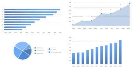
The global Digital Aerial Photography System market size was valued at approximately USD 2.8 billion in 2025 and is projected to reach USD 4.5 billion by 2035, growing at a CAGR of 4.8% during the forecast period. The market encompasses systems that include advanced cameras, navigation technology, and data analysis tools used for capturing high-resolution photographs from aerial perspectives. These systems are heavily utilized in sectors like geospatial mapping, urban planning, environmental studies, and defense. The industry ecosystem involves technology providers, software developers, and end users in applications ranging from agriculture to media. This market plays a pivotal role in delivering vital data for critical decision-making processes across diverse sectors.
Market Scope Includes:
- Product / Solution Coverage
- Aerial cameras
- Navigation tools
- Data processing software
- Technology Coverage
- Light detection and ranging (LiDAR)
- Photogrammetry
- GPS & GIS modules
- Application Coverage
- Urban planning
- Environmental monitoring
- Agricultural management
- Value Chain Coverage
- Manufacturers/providers
- Technology suppliers
- Distribution channels
- End users
Drivers Impact Analysis
| Driver |
(~) % Impact on CAGR Forecast |
Geographic Relevance |
Impact Timeline |
| Rising demand for geospatial intelligence |
+1.4% |
Global |
Medium Term (2“4 Years) |
| Advancements in imaging technology |
+1.0% |
North America, Europe |
Long Term (≥4 Years) |
| Increased use in environmental monitoring |
+0.8% |
Asia Pacific, Europe |
Medium Term (2“4 Years) |
| Integration with AI and Machine Learning |
+0.6% |
Global |
Long Term (≥4 Years) |
| Expansion of smart cities initiatives |
+0.7% |
APAC, North America |
Medium Term (2“4 Years) |
Market Growth Analysis and Industry Transformation
Historically, the Digital Aerial Photography System market has evolved from basic imaging systems to highly sophisticated technologies capable of providing critical insights for environmental and urban planning. Currently, the market is experiencing moderate growth spurred by technological advancements and increasing industry applications. Over the next decade, the market is forecasted to see accelerated growth driven by advancements in imaging technology and the growing need for high precision geospatial data. Demand dynamics reveal an increase in customer requirements for integrated systems that offer both data capture and analysis, aligning with trends towards smarter cities and comprehensive environmental monitoring initiatives. Investment activity within the market is likely to focus on research and development to enhance technology capabilities and expand geographical outreach.
Segmental Market Analysis
The product type segment has dominated the market, primarily due to the extensive utilization of aerial cameras which play a crucial role in high-resolution image capturing necessary for detailed analysis in various applications. The application segment is poised for the fastest growth, particularly in urban planning and environmental monitoring, driven by increased awareness and regulatory mandates for environmental preservation and urban development. Emerging segments include integration technologies such as AI and GIS systems which are drawing investments due to their potential to transform data capture and analysis methodologies.
Technology, Innovation and Future Transformation
The digital aerial photography system market is undergoing a transformation with significant investments in AI-driven data processing and advanced navigation technologies such as LiDAR and photogrammetry. Continued innovations in image sensors and data analytics are expected to drive market growth, enabling more accurate and detailed geospatial information delivery. These technological advancements are likely to influence competitive dynamics, lead to the emergence of new business models, and change traditional pricing strategies as companies adopt more integrated and value-added solutions.
Value Chain, Supply Chain, Cost and Profitability Analysis
The value chain for digital aerial photography systems begins with the raw materials and components suppliers who provide essential imaging and navigation equipment. Manufacturing processes integrate advanced technology capabilities with robust software systems to create comprehensive solutions for end users. The downstream ecosystem is characterized by diverse distribution channels that deliver products to end users in sectors like agriculture, defense, and urban planning. The cost structure is heavily influenced by technology input costs and the integration of sophisticated systems, impacting profit margins across different stages of the supply chain.
Regulatory, Policy and Industry Standards Analysis
Regulatory frameworks play a pivotal role in shaping the market environment, particularly in regions with stringent airspace usage regulations and environmental standards. Compliance with national and international regulatory mandates is essential for market entry and operational licenses, influencing competitive positioning and costs. Adherence to industry standards and achieving certifications enhance credibility and can be a significant differentiator in this technology-driven market landscape.
Regional Market Insights
North America: Holding a leading market share, North America's growth is driven by high technology adoption rates, substantial investments in R&D, and significant government initiatives supporting smart city projects. The region is mature with a well-established industry network and continues to invest in upgrades and technological advancements.
Europe: The European market is growing due to regulatory requirements for environmental conservation and urban development. Countries like Germany and the UK are at the forefront, leveraging technological advancements to meet sustainability goals.
Asia Pacific: This region is anticipated to witness the fastest growth, propelled by increasing industrialization, governmental focus on infrastructure development, and rising awareness regarding sustainable practices. The availability of cost-efficient manufacturing solutions further enhances regional attractiveness.
Latin America: Emerging opportunities in agriculture and environmental monitoring create growth potential, with countries like Brazil and Mexico showing promise due to favorable government policies and investments.
Middle East & Africa: Market development in this region is driven by infrastructure expansion and defense sector investments, positioning it for gradual growth as industry awareness and technology adoption increase.
Competitive Landscape and Strategic Analysis
The report evaluates competitive benchmarking, company positioning matrix, and market share analysis. The market is moderately consolidated with key players like DJI, Hexagon AB, and Trimble Inc. holding significant market shares due to their expansive product portfolios and strategic geographic presence. Competitive strategies include technological innovation, strategic partnerships, and acquisition activities designed to enhance capabilities and expand market reach.
Consulting Framework Insights
Integrating frameworks such as Porter™s Five Forces provides insights into market competition intensity, the threat of new entrants, and the bargaining power of suppliers and buyers. PESTLE analysis highlights the political and economic factors influencing market growth. Market attractiveness insights guide stakeholders on lucrative investment opportunities and strategic decision-making processes.
Analyst View
Over the next 5“10 years, companies operating in the Digital Aerial Photography System market are advised to prioritize investment in AI-integrated solutions and regional expansion, particularly in the Asia Pacific. Rich opportunities for growth exist, driven by increased data demand from urban planning and environmental conservation sectors. Strategic alliances and adopting state-of-the-art technologies will differentiate leaders from competitors. Companies should be vigilant of regulatory changes that could impact operations, while innovation in product offerings should remain a core focus to capture emerging opportunities and maintain competitive advantage.
Detailed Market Segmentation & Sub-Segmentation
By Product Type
- Aerial cameras
- Compact cameras
- Full-frame cameras
- Navigation tools
- Inertial navigation systems
- GPS modules
By Technology
- Light Detection and Ranging (LiDAR)
- Topographic LiDAR
- Bathymetric LiDAR
- Photogrammetry
- Orthophotography
- 3D photogrammetry
By Application
- Urban planning
- Civic planning
- Transport management
- Environmental monitoring
By End User
- Government agencies
- Defense
- Civil infrastructure
- Commercial enterprises
By Region
- North America
- Europe
- Asia Pacific
- Latin America
- Middle East & Africa
- Saudi Arabia
- South Africa
Our Market Research Solutions
- Comprehensive multi-industry market analysis
- Competitive intelligence data dashboards
- Emerging innovation & disruption tracker
- Market sizing & statistical forecasting tools
- Industry trend intelligence reports
- Consumer & B2B behavior analytics
- Customized data-driven research solutions
Know more about reports
Enterprise Research Solutions
- Company identification & market mapping
- Operational scale & geographic footprint analysis
- Performance benchmarking & KPI monitoring
- Regulatory & compliance insights
- Commercial viability assessment
- Stakeholder & ecosystem relationship mapping
Connect with our expert
Category Intelligence Solutions
- Industry category overview & segmentation
- Demand patterns & application insights
- Pricing models & cost structure analysis
- Market dynamics & competitive structure
- Value chain & distribution mapping
- Operational benchmarks & industry standards
- Key reports & statistical deliverables
Explore Reports Suite
Customer Insights Analytics
- Customer profiling & segmentation analysis
- Spend analysis & opportunity assessment
- Procurement strategy & sourcing models
- Vendor evaluation criteria & expectations
- Contract structures & policy frameworks
- Market entry & engagement strategy
- Pain points & decision-making drivers
- Research findings & analytical insights
Speak with our experts
Pricing Intelligence Solutions
- Price benchmarking & comparative analysis
- Market trends & statistical insights
- Indexation models & pricing adjustment analysis
- Total cost of ownership evaluation
- Commercial frameworks & contract structures
Speak with our experts
Brand Intelligence Solutions
- Brand positioning across industries
- Market share & competitive benchmarking
- Customer perception & brand analytics
- Go-to-market performance strategy
- Digital presence & reputation analysis
- Performance metrics & growth opportunities
Connect with our expert