Share


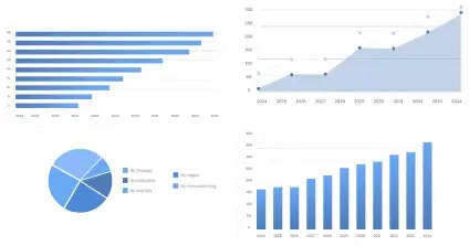
The US Geospatial Analytics market size was valued at approximately USD 5 billion in 2025 and is projected to reach USD 12 billion by 2035, growing at a CAGR of 9% during the forecast period. Geospatial analytics involves the gathering, display, and manipulation of imagery, GPS, satellite photography, and historical data, described explicitly in geographic information systems (GIS). The market primarily caters to sectors requiring location-based data processing including urban planning, transportation, defense, agriculture, and energy.
Geospatial analytics transforms decision-making across industries by integrating geographic data with information systems to support infrastructure planning, resource management, and risk assessment. With high applicability across key economic sectors and robust government initiatives aimed at enhancing national security and spatial data infrastructures, geospatial analytics represents a critical node in the technological ecosystem.
With an estimated market share of 40%, this segment represents one of the major contributors to industry revenue. The diversity in geospatial technology products, offering utilities from basic spatial visualization to advanced spatial analysis, drives this segment. Higher demand is catalyzed by formidable software innovations and widespread adoption across multiple verticals ranging from seismic monitoring to navigation systems.
Software – 50%: Software solutions dominate the category due to advanced capabilities and integration with mobile and web platforms.
Hardware – 30%: Hardware, though secondary, remains essential for data acquisition and integration.
Services – 20%: Services offer customization and specialized analytical expertise crucial for business intelligence.
This segment accounts for approximately 35% of the overall market, mainly driven by its versatility and the ability to provide tailored solutions for critical industries such as utilities, natural resources, defense, and logistics. Geospatial applications notably influence decision-making processes through their definitive data analysis structures better aligning strategies with spatial intelligence.
Urban Planning – 40%: Urban Planning applications dominate this category driven by increasing metropolitan development demands.
Defense & Intelligence – 35%: Critical for strategic operations and national safety, maintaining significant share.
Natural Resources – 25%: As resource management grows stringent, geospatial analytics aid in efficient resource allocation.
This segment, contributing 15%, is pivotal in determining the market's technological direction. Advanced technologies like artificial intelligence, machine learning, and big data analytics are enhancing the breadth and precision of geospatial analytics.
GIS – 45%: Geographic Information Systems are foundational technologies driving up their contribution.
Remote Sensing – 35%: Remote sensing’s high-precision capabilities in capturing extensive land data make it integral.
GPS – 20%: GPS remains crucial due to its real-time tracking abilities enhancing logistics and transportation operations.
Occupying a 10% market share, this segment benefits from extensive industrial reliance ranging from agriculture to real estate in improving operational efficiencies and strategic positioning.
Agriculture – 40%: Agriculture leverages geospatial analytics for precision farming and yield enhancement.
Transportation – 35%: Optimization of routes and improved navigation significantly enhances transporter efficiency.
Utilities – 25%: Critical for operational efficiency in energy and water utilities, serving grid management needs.
| Impact Factor | (~) % Impact on CAGR Forecast | Geographic Relevance | Impact Timeline |
|---|---|---|---|
| Government Initiatives & Funding | +1.2% | North America | Medium Term |
| Advanced Technology Adoption | +1.0% | North America | Medium to Long Term |
| Increase in Demand for Satellite Imaging | +0.8% | North America | Medium Term |
| Integration with AI and ML | +1.5% | Global | Long Term |
| Growing Urbanization | +0.9% | North America | Medium Term |
Historically, the geospatial analytics market has been predominantly utilized in defense and urban planning with significant contributions toward strategic operation analysis. Currently, the market enjoys a robust growth phase with increased adoption in commercial sectors driven by precision-based tools and software. Future prospects look promising with emerging frontiers in technology paving the way for the growth of next-generation analytics systems capable of real-time data processing and predictive analysis.
Demand dynamics reflect an increasing trend towards real-time data usage and predictive analytics within urban and environmental planning frameworks. Investment trends denote an upward trajectory, evidenced by notable CAPEX growth and industry investment in innovative technologies tailored towards scalable solutions. Geospatial analytics is driven by technology innovation, regulatory support, and expanding geographical applications; however, market challenges such as cost barriers and supply constraints persist.
The leading segment by product type is software, accounting for the majority of the market share due to its adaptability across applications and capacity to process complex geospatial data. However, the fastest-growing segment is likely to be services due to increased demand for specialized geospatial consultancy and strategic analytical services. Emerging segments, such as remote sensing technology, possess significant innovation potential and continue to attract investment due to its diverse applications in spatial planning and agriculture.
Significant advancements in geospatial technologies are reshaping the market, highlighting the transition towards AI-enhanced analytical tools and machine learning integration, which are increasingly recognized for their predictive capabilities. The innovation pipeline is enriched by research in developing intelligent systems capable of autonomous geographical data interpretation, potentially transforming business models by allowing real-time decision-making and reducing operational latency. Digital transformation spearheaded by AI, automation, and advanced analytics is fundamentally altering pricing and competitive landscapes, enabling companies to deliver enhanced solutions with superior spatial intelligence capabilities.
The geospatial analytics market spans a multi-tier value chain involving data providers, software vendors, technology integrators, and end-users. The upstream ecosystem focuses on satellite imagery and data procurement, significantly influenced by supplier availability and environmental policies. Midstream includes technology integration and service delivery, where capacity utilization and technological adoption determine operational efficiency. Downstream dynamics involve distribution and end-user applications, pivotal in demand fulfillment and considering customer segments’ varied needs. PI insights reveal a streamlined supply chain distinctly impacts margin distribution, with strategic partnerships fostering profitability while addressing pricing fluctuations.
Government policies significantly influence the geospatial analytics market in the US, with regulations often dictating market entry and operational costs. Compliance and certifications such as ISO standards and national geospatial data provisions shape industry practices, aiding competition and promoting innovation in technology deployments. Stringent regulatory environments can lead to increased operational costs but also foster a highly competitive and innovation-driven market landscape crucial for continual transformative advancements.
The US geospatial analytics market exhibits a fragmented structure characterized by numerous active players ranging from established companies to innovative startups. Leading firms like Esri, Trimble, and Hexagon dominate the landscape with expansive geographical presence and diversified product portfolios. Innovation strategies primarily focus on enhancing user-centric software solutions and integrating AI for real-time data empowerment. Partnerships and M&A activities are frequent, aimed at technology enhancement and expanding service capabilities, which the report highlights through competitive benchmarking, company positioning matrix, and market share analysis.
Leveraging Porter's Five Forces and PESTLE analyses, the market is highly attractive, with rapid technological advancements offsetting competitive pressure. Investment in R&D and geographic expansion is pivotal for maintaining innovation momentum and establishing market dominance. Metrics indicate a highly attractive market for long-term growth.
Over the next 5–10 years, the US geospatial analytics market is set for substantial transformation driven by technological innovations and increasing investment in infrastructure development. Companies should focus on the software segment for its adaptability and innovation potential. Geospatial analytics in urban planning and agriculture presents significant growth opportunities, primarily driven by digital transformations in those verticals. However, controlling operational costs and addressing supply constraints remain crucial challenges. To excel, companies must enhance AI and big data integration capabilities and actively pursue strategic partnerships, thereby sustaining competitiveness and securing leadership in an evolving market landscape.
To get full access to our Market Insights, you need a Professional Account or a Business Suite.


You will receive an email from our Business Development Manager. Please be sure to check your SPAM/JUNK folder too.
You will receive an email from our Business Development Manager. Please be sure to check your SPAM/JUNK folder too.
Our customers work more efficiently and benefit from